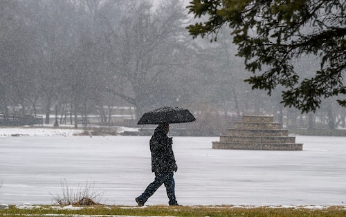
Ahead of a rare winter storm that is predicted to deliver heavy snow and disruptive ice accumulations to the region into Wednesday, Texas and other regions of the South experienced frigid temperatures on Monday. Residents hurried to fill emergency kits, insulate pipes, and check heating systems.
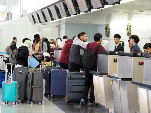
Both Houston’s George Bush Intercontinental Airport and Texas’ William P. Hobby Airport said on Sunday evening that airline operations would be halted Tuesday due to potentially dangerous weather.
Meanwhile, severely cold weather were plaguing individuals from the Northern Plains to the point of Maine.On Monday morning, temperatures dropped far below average due to an Arctic air mass, with wind chills that are dangerously cold. Meanwhile, the East Coast is dealing with a heavy layer of snow.
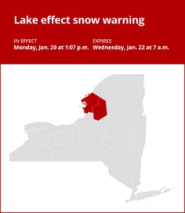
Heavy snow, sleet, and freezing rain are predicted to persist in the area through Wednesday, according to winter storm warnings that were issued Monday from Texas to Florida. From Monday through Wednesday morning, heavy lake-effect snow was predicted for western New York state, with some locations, including Oswego in Lake Ontario, potentially receiving 1 to 2 feet (30 to 61 cm).
Up to 70 million people might be under a winter storm warning in the next few days, according to Marc Chenard, a meteorologist with the National Weather Service in College Park, Maryland.
Snow on the Gulf Coast
Beginning Monday, up to 30 million people in the South could experience a wintry mix of snow, sleet, and freezing rain as the cooler temperatures move into the region. It is anticipated that the extraordinary conditions would extend from Texas into the Carolinas and northern Florida.
On Monday, the Florida panhandle, Alabama, Mississippi, and Texas were under a winter storm warning. Heavy snow was predicted along and north of the Interstate 10 corridor, along with sleet and freezing rain in south Texas, southeast Georgia, and northern Florida, as the storm moved eastward through Wednesday morning after making landfall in Texas on Monday night.
There were several freeze warnings in effect for much of the Gulf Coast and northern Florida. In regions that are not used to severe winter temperatures, forecasters said that exposed pipes and delicate vegetation could be at risk due to the subfreezing morning lows.
Officials in Louisiana warned that travel could be dangerous when roads ice up and refreeze in the days ahead, and they urged citizens to stay at home and avoid going sightseeing once the storm and subfreezing temperatures hit.
Warming centers were being prepared, and towns were working to get homeless people off the streets and into safe places, since Tuesday is predicted to be the worst weather day due to the storm and freezing temperatures are predicted every night through Friday. In many places, supermarkets and other retail establishments have been crowded with customers preparing for the chilly months ahead.
According to William Jordan on Monday, the past few days had been extremely hectic with everyone shopping and attempting to collect supplies. Most people were searching for the same items because they wanted to prepare something that would warm your heart, like gumbo.
He was born in Connecticut and has spent the last ten or so years living in the New Orleans region.
Although many people down here are a little agitated since they rarely have to deal with the (weather) conditions they anticipate, I believe that people are generally prepared for it and only want to enjoy the snow in a safe manner.
Flights were canceled because of the cold, but Lakesha Reed, manager of Beaucoup Eats catering in New Orleans, said she had intended to go Tuesday to prepare food for a Mardi Gras-style celebration in Washington, D.C.
The 47-year-old Reed grew up in New Orleans. Near-freezing temperatures are uncommon in that area, and it was in the 30s F early Monday afternoon, she said.
She remarked, “We can hardly drive in the rain.” We wore shorts for Mardi Gras last year. Here, we don’t actually have seasons.
Because of the forecasted extreme cold, the higher demand for electricity, and the potential for fewer backups, the Electric Reliability Council of Texas issued a weather watch through Thursday. However, the council stated that network conditions should be normal.
The weather service warned that power outages might occur in regions with considerable snow and ice, which could worsen the effects of the cold weather. From Monday night through the remainder of the week, widespread sub-freezing nightly lows were predicted along the Gulf Coast.
New Orleans officials canceled a Martin Luther King Day celebration they had scheduled for Monday due to the storm and abnormally chilly temperatures.
This winter, a large portion of the Eastern Seaboard will experience some of the lowest temperatures.
Temperatures are expected to fall to between minus 30 degrees Fahrenheit (minus 34 degrees Celsius) and minus 55 degrees Fahrenheit (minus 48 degrees Celsius) on Monday, bringing colder-than-normal weather to an area from the Rockies into the Northern Plains over the course of several days. As far south as Oklahoma and the Tennessee Valley, sub-zero wind chills are predicted.
Minnesotans were advised to pack a survival kit and dress appropriately for their trip. In order to stay in contact with loved ones, drivers should also keep their cellphones fully charged and their gas tanks full, according to Kristi Rollwagen, director of homeland security and emergency management at the Minnesota Department of Public Safety.
Since peak temperatures in many locations were only predicted to reach the single digits or teens on Monday and Tuesday, the weather service issued cold weather advisories throughout the Great Lakes region. Temperatures could dip to minus 20 F (minus 29 C) or lower at night due to wind chills. Chicago was predicted to reach a high of 10 degrees Fahrenheit (minus 12 degrees Celsius) on Monday alone, and a low of minus 5 degrees Fahrenheit on Monday night.
This latest cold snap, like the one that occurred earlier this month, is caused by a disruption in the polar vortex, which is the ring of frigid air that is often confined around the North Pole.
Santa Ana winds expected to return to Southern California
Strong Santa Ana winds were predicted to return Monday with gusts between 70 and 90 mph (roughly 113 to 145 kph) in Southern California, where fires have destroyed thousands of homes and killed at least 27 people, according to Andrew Rorke, a senior forecaster with the weather service in Oxnard, California.
These winds should provide some cover for the Eaton and Palisades fires, but additional winds with reduced humidity will make combating the fire more difficult, Rorke said. According to Rorke, a red flag warning that is especially dangerous is in effect through Tuesday, which means that, should a fire break out, the conditions are ideal for explosive fire growth.
On the plus side, Rorke added, rain is predicted over the weekend, with a quarter to a half inch (0.63 to 1.27 cm) of precipitation anticipated.


+ There are no comments
Add yours