
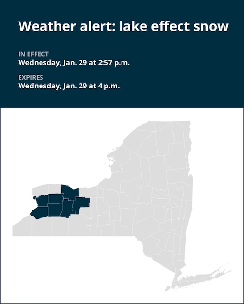
At 2:57 p.m. on Wednesday, the National Weather Service issued a report predicting lake effect snow in Monroe, Erie, Genesee, Wyoming, Livingston, and Ontario counties through 4 p.m.
“At 2:54 p.m., a band of moderate to heavy lake effect snow showers was along a line extending from near Chili to near Attica to Cheektowaga and moving east at 25 MPH,” according to the National Weather Service.
Henrietta, Elma, Marilla, Le Roy, Perry, Warsaw, Avon, Bennington, Mount Morris, Victor, Geneseo, Buffalo, Cheektowaga, West Seneca, Batavia, Depew, Canandaigua, Lancaster, Geneseo, and Darien Lakes State Park are among the places affected by the alert. The following roadways are included in this: Interstate 390 from exits 8 to 12. Between exits 43 and 47 and between exits 52A and 53 on Interstate 90.
“In winter weather conditions, conditions can rapidly deteriorate,” the weather service says. Be ready for roads covered with ice or snow. To get to your destination, slow down and give yourself more time.
United Robots offers a service called Advance Local Weather Alerts that gathers the most recent information from the National Weather Service using machine learning.


+ There are no comments
Add yours