
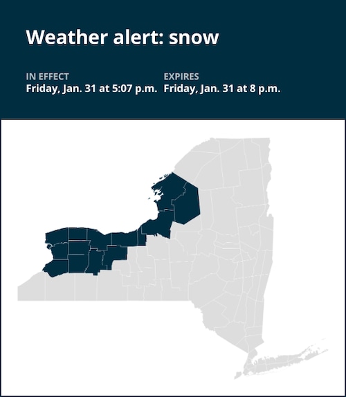
Rain and snow were predicted for Niagara, Orleans, Monroe, Wayne, Cayuga, Oswego, Jefferson, Lewis, Erie, Genesee, Wyoming, Livingston, and Ontario counties through 8 p.m. on Friday, according to a National Weather Service report released at 5:07 p.m.
“Late this afternoon, widespread rain has already turned to snow in parts of the Tug Hill region and the Niagara Frontier. Early this evening, when colder air moves into the area, the rest of the area will swiftly turn to wet snow. This evening, most places could expect a general slushy accumulation of 1 to 3 inches, with some spots in the Tug Hill Plateau seeing up to 4 inches. With the change to snow, roads will quickly become mushy, blanketed in snow, and extremely slick. The meteorological office predicts that by mid-evening, temperatures will start to fall into the 20s and that untreated surfaces will turn slippery.
United Robots offers a service called Advance Local Weather Alerts that gathers the most recent information from the National Weather Service using machine learning.


+ There are no comments
Add yours